Your venue, inside the Google Maps everyone already has.
Draw your zones, pins, and upload your icons on a real map. Share one link and it opens directly in Google Maps with all the features you already know. No other app required.
Open the editorFree · your first map in about 2 minutes
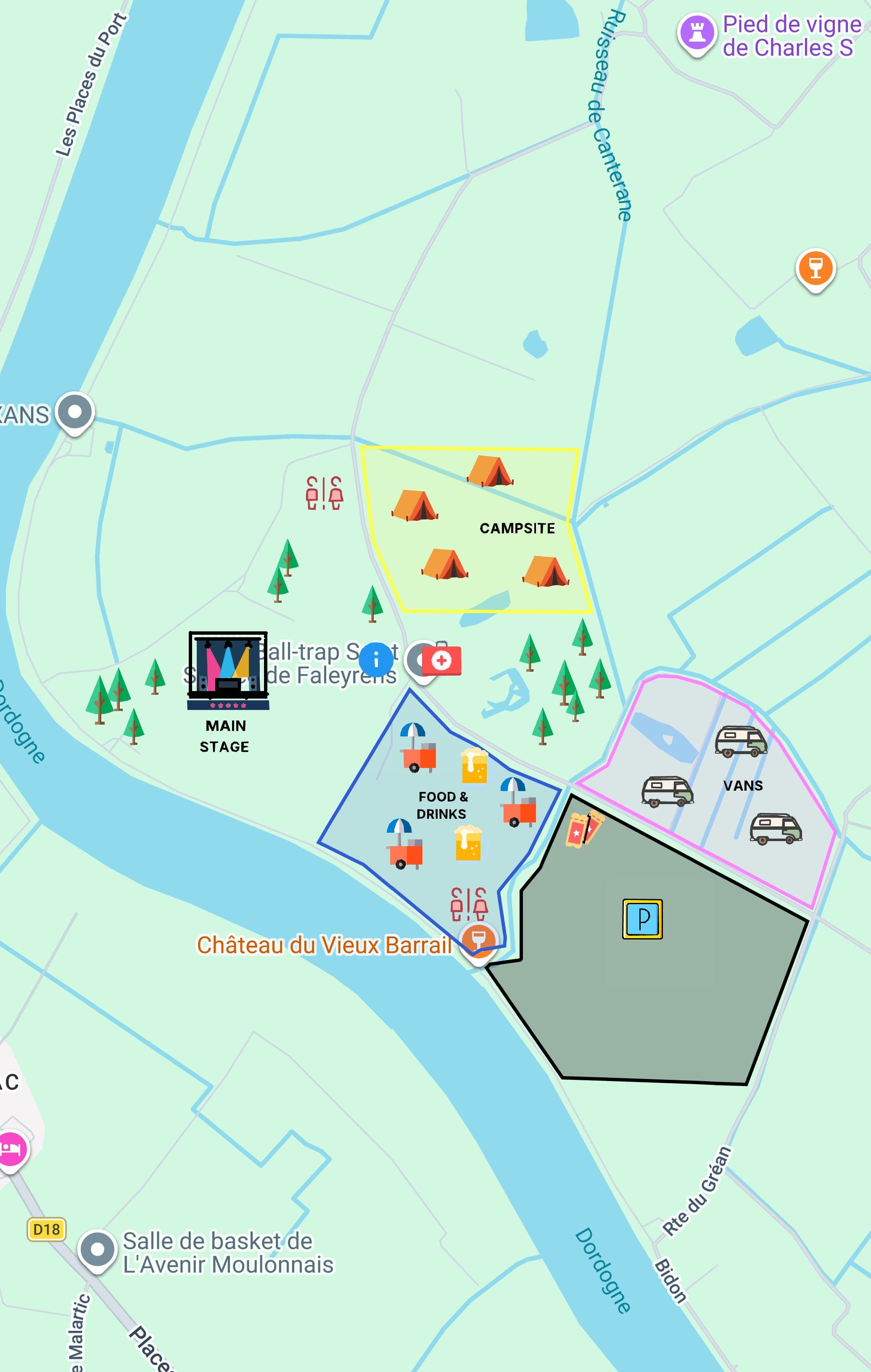


From blank map to branded link in three steps.
No design degree required. No technical setup. Under ten minutes start to share.
Draw it your way.
Sketch routes, zones, and pins right over Google Maps. Upload SVGs for custom markers, logos, and labels. Everything lives in your browser - nothing uploaded to a server.
Download your map.
One click turns your design into a Google-native file, ready to import into Google My Maps right away.
Import to Google My Maps.
Drop the file into Google My Maps once. Share the link anywhere. Recipients get a real, interactive map - zoom, directions, save locations - on any device.
A picture of a map isn't a map.
Other tools hand you a static image or trap your work in their own viewer. Maptide gives you an actual Google Map. That means real zoom, real search, real turn-by-turn directions - on the app every guest already has installed.
- Static image - can't zoom or navigate
- Proprietary viewer - another app to open
- No directions, no save, no offline
- Breaks if the viewer goes down
- Real Google Map - zoom, search, navigate
- Opens in the app they already have
- Save places, get directions, works offline
- Backed by Google's infrastructure forever
For the people whose plans live on a map.
Weddings & Events
Venue, parking, hotel block, and reception - one link on the invite. Your guests navigate, not squint at a screenshot.
Festivals & Venues
Stages, food, restrooms, entrances. Share it natively so every attendee can always find their way.
Camping & Retreats
Cabin locations, the dock, fire pits, bathrooms. Share with the whole group before anyone arrives.
Races & Runs
Course route, aid stations, start/finish, bag drop. One link your runners open on race morning.
Markets & Street Food
Stall grid, vendor names, entrances. Your vendors know their spot; your guests know where to find them.
Maptide at a glance
- Output is a real Google My Maps link, not an image or a custom viewer.
- People you share the map with open it in the Google Maps app or browser they already have - no account or install needed to view it.
- Creating a map requires a free Maptide account.
- The editor runs in your browser; your map design isn't uploaded anywhere until you export it.
- Free: $0 - the full editor, KML export, and a monochrome icon library (2,000+), with a watermark on export.
- Pro: $14/mo or $140/yr - no watermark, satellite view, custom SVG upload, save/load, and PDF export.
Common questions
Yes. Creating a map requires a free Maptide account. Free: $0 - the full editor, KML export, and a monochrome icon library (2,000+), with a watermark on export. Pro: $14/mo or $140/yr - no watermark, satellite view, custom SVG upload, save/load, and PDF export.
Compare plans on the pricing pageNo. They open a normal Google Maps link in their browser or the Maps app they already have installed. No signup, no download, nothing extra.
No. You design your overlay in the Maptide editor, export a KML file, and import it into Google My Maps, so the finished map lives in your own Google account and you don't set up any API keys.
Not natively. Google's own My Maps import help lists image and screen overlays among the KML features that may not import. Maptide's export is made of shapes, lines, and icons, which My Maps does import, so you can rebuild the look of an overlay as vector shapes.
Read the step-by-step guideKML is Google's native map format - the same one Google Earth and Google My Maps use. Maptide generates it for you. To open it, go to Google My Maps, choose Create a new map, click Import, and choose the file; you only do this once.
It's Google's free tool for building and sharing custom maps - you drop pins, draw lines, and organize everything into layers. It's also where the map Maptide generates for you actually lives and gets shared.
It's any custom layer of pins, lines, shapes, or labels placed on top of a real map. Maptide is the design tool for building that overlay - you style it, and it exports as a KML you drop straight into Google My Maps.
No. Maptide designs map overlays people navigate - event grounds, venues, routes, zones. It doesn't do spatial analysis, shapefile or GeoJSON data layers, route optimization, or asset tracking; for those, use QGIS or ArcGIS. Maptide exports KML only. The map it produces is a real Google Map, so your guests still get search, directions, and live traffic from Google.
Not until you export it. You'll need a free account to open the editor, but your map design itself is built entirely in your browser - it never leaves your machine until you choose to export it. See our Privacy Policy for exactly what account data we collect.
Yes - the shared map link opens in Google Maps on any device: iPhone, Android, whatever. The Maptide editor is best on desktop, but your recipients get the full mobile experience.
Yes. Make your changes in Maptide, export a new KML, and re-import it into your existing Google My Maps to update it. The share link stays the same.
Design your overlay in Maptide - mark the ceremony spot, stages, parking, whatever your guests need - then export a KML and import it into Google My Maps. You get one link that opens as a real, navigable map for everyone invited.
Google My Maps is where your map ends up living and gets shared - Maptide is the design tool. My Maps alone gives you basic pins and lines; Maptide lets you design a custom-styled overlay first, then hands you a KML that drops straight into My Maps.