A campground map maker guests actually use before they pull in.
Build a custom map of your campground or RV park - tent sites, RV loops, bathhouses, the dump station - and share it as a real Google Maps link. No scanned PDF, no hand-numbered photocopy at the registration window.
A real campground map: Švihov Reservoir, Czech Republic
LiveA lakeside site along the Švihov Reservoir, with tent sites, RV loops, a campfire circle, a boat launch, and the camp store all marked on the real property. This isn't a mockup below - drag it, zoom it, click a pin. It's a real Google Map.
This is what your own guests will get: a real, working map, not a PDF.
The campground map problem nobody plans for
A campground or RV park isn't one address - it's loops and sections, individually numbered spots, a shared bathhouse or two, a dump station everyone asks about on checkout morning, and a camp store that closes earlier than guests expect. Most parks solve this with a scanned paper map attached to the booking confirmation email, a photocopy taped to the registration window, or a verbal “loop B, past the playground” from whoever's at the desk. None of it is clickable, none of it gives turn-by-turn directions to a specific site, and all of it goes stale the moment a loop gets renumbered or a fire ring moves.
A custom campground map fixes this by keeping the real Google Maps underneath your design - guests get the navigation app already on their phone, with your site numbers, loops, and amenity icons layered on top so nobody's circling the property looking for site 47 or the nearest shower.
Design → export → share, in three steps
Place free icons on the real property
Search your campground's address, then drop a free tent icon straight from the library - no paywall on the icons a campground map actually needs.

Build out the full site map
Add RV sites and tree cover next to the tent loop - drag each icon to its real spot on the property, no ruler or GPS unit needed.

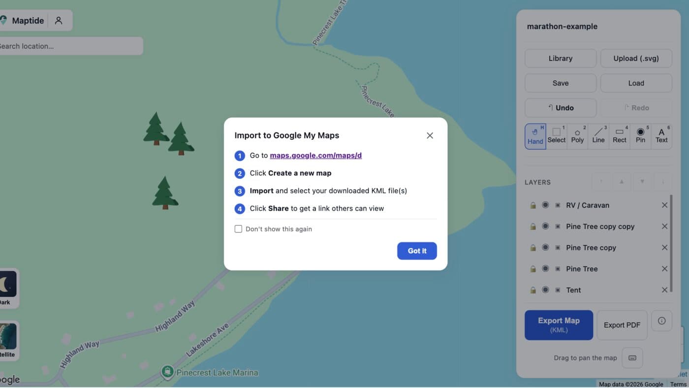
Export to KML and open it in Google My Maps
One click exports a geo-accurate KML file. Import it into Google My Maps and paste the resulting link into booking confirmations or a front-gate QR code.
Everything guests ask the office about, marked on one map
Site & loop numbers
Match your booking platform's numbering so "Site 47" means the same thing on the map and at check-in.
Bathhouses & showers
Mark every shared facility so guests don't wander loop to loop looking for one.
RV & tent sites
Show which spots fit a 40-ft rig and which are tent-only, right on the map.
Dump station & fill-up
One pin for the spot everyone asks about on checkout morning.
Camp store & office
Where to check in, buy firewood, and find the wifi password.
Trails, dock & fire pits
The parts of the property guests actually explore once they've set up camp.
Common questions
How do I make a map of my campground or RV park?
Search your property's address in Maptide to pull up the real Google Map underneath, then drag free icons - tent, RV, pine tree, and more - onto each loop, site, and shared facility. Export it as a KML file and import it into Google My Maps to get a real, live link. No GIS software or design skills required.
Can guests use it without downloading an app?
Yes. The output is a real Google Maps link, so it opens in the Google Maps app or browser guests already have. Nothing to install, nothing that needs a login just to view a site location.
What's the difference between this and the scanned paper map we email guests?
A scanned PDF is a flat image - guests can't tap their site number for directions, and it goes stale the moment a loop gets renumbered or a fire ring moves. A Maptide map stays on top of the real Google Map, so guests get actual turn-by-turn navigation to their specific site, and you can update pins any time without re-scanning anything.
Can I show site numbers that match my booking platform?
Yes - label each pin with the exact site number or loop name your booking system uses, so a guest who reserved "Site 47" can find 47 on the map without guessing which numbering scheme is in effect.
Does it cost anything to make a campground map?
The editor and KML export are free, and the tent, RV, and pine-tree icons used in the example above are free on every tier - no paywall for the icons this page shows. A small watermark appears on free exports; removing it and unlocking satellite view and custom SVG uploads is part of the paid Pro tier. See Pricing for details.
Season's booking up fast?
Build your campground map before the next reservation confirmation goes out - it takes less time than answering one “where's the dump station” email.
Start your campground map