A race course map maker runners check before the gun goes off.
Build a custom course map for your 5K, marathon, or trail run - start/finish, aid stations, bag drop - and share it as a real Google Maps link. No zoomable PDF, no hand-drawn arrows on a static graphic.
A real race course: the New York City Marathon
LiveThe full 26.2-mile route from Staten Island through all five boroughs, mile by mile. This isn't a mockup below - drag it, zoom it, click a mile marker. It's a real Google Map.
This is what your own runners will get: a real, working map, not a PDF.
The race map problem nobody plans for
A race course isn't a single location - it's a start line, a route that might close roads or cut through a park, aid stations spaced every mile or two, and a bag-drop area that needs to be easy to find on both ends. Most races solve this with a PDF course map that's illegible once you're zooming around on a phone, a static graphic with hand-drawn arrows, or a course description in prose that assumes you already know the roads. None of it gives runners turn-by-turn directions to the actual start line, and all of it needs reprinting the moment a road closure changes the route.
A custom race course map fixes this by keeping the real Google Maps underneath your route - runners get the navigation app already on their phone, with your aid stations and bag-drop icons layered on top so nobody's asking a volunteer where mile 9's water stop is.
Design → export → share, in three steps
Mark the route
Search your race's location, then place a bicycle icon on the real course route along the loop.

Add runners along the course
Place runner icons at key points along the route, positioned exactly where they'll be on race day.

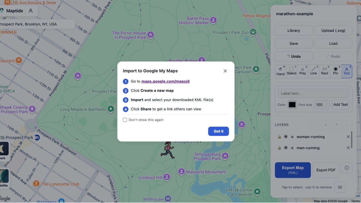
Export to KML and open it in Google My Maps
One click exports a geo-accurate KML file. Import it into Google My Maps and paste the resulting link into your race website or the pre-race runner email.
Everything runners check the morning of, marked on one map
Start & finish line
The exact spot, not just a pin somewhere near the park.
Aid stations
Water and fuel stops spaced along the real course, mile by mile.
Bag drop
One clear spot on both ends so nobody's hunting for their gear bag.
Mile markers
Label each segment so runners can pace themselves against the real route.
Restrooms & medical
The practical stuff race directors get asked about most.
Bib pickup & parking
Where to go before the race even starts.
Common questions
How do I make a custom race course map for a 5K or marathon?
Search your start line's address in Maptide to pull up the real Google Map underneath, then place icons for the start/finish, aid stations, and bag drop along the actual route. Export it as a KML file and import it into Google My Maps to get a real, live link runners can open on race morning.
Can runners use it without downloading an app?
Yes. The output is a real Google Maps link, so it opens in the Google Maps app or browser runners already have installed. Nothing to install, nothing that needs a login just to check where the next aid station is.
What's the difference between this and the PDF course map on our race site?
A PDF is a flat image runners have to zoom and pan around on their phone the morning of. A Maptide map keeps the real Google Map underneath your course, so runners get actual turn-by-turn navigation to the start line and tappable pins for every aid station - and you can update it the moment a road closure changes the route.
Can I mark mile markers or elevation on the course?
Yes - label each pin with the mile number, aid station name, or any course detail you want runners to see, positioned exactly where it happens on the real route underneath.
Does it cost anything to make a race course map?
The editor and KML export are free. A small watermark appears on free exports; removing it and unlocking satellite view and custom SVG uploads is part of the paid Pro tier. See Pricing for details.
Race day on the calendar?
Build your course map before bib pickup - it takes less time than briefing the aid station volunteers.
Start your race map