A neighborhood amenity map buyers actually explore.
Build a custom amenity map for a listing or a whole development - the property, the clubhouse, the gated entry - and share it as a real Google Maps link. No static graphic with amenities floating near a property outline.
A real amenity map: a Phoenix neighborhood near Bessemer Park
LiveA listing with routes drawn to the nearest bakery, gym, chapel, restaurants, and the neighborhood park - real distances, not floating icons. This isn't a mockup below - drag it, zoom it, click a pin. It's a real Google Map.
This is what your own buyers will get: a real, working map, not a PDF.
The amenity-marketing problem nobody plans for
A listing or a new development isn't sold on square footage alone - it's sold on what's around it: the clubhouse, the gated entry, the school district, the restaurant row five minutes away. Most agents and developers solve this with a static graphic showing amenity icons scattered near a property outline, a paragraph in the listing description naming nearby landmarks, or nothing beyond an IDX map pin at the address itself. None of it shows a buyer real distances or actual routes, and all of it looks the same as every other listing's amenity graphic.
A custom amenity map fixes this by keeping the real Google Maps underneath your development - buyers get the navigation app already on their phone, with your listing and amenity icons layered on top so a lackluster street address turns into a neighborhood they can actually picture living in.
Design → export → share, in three steps
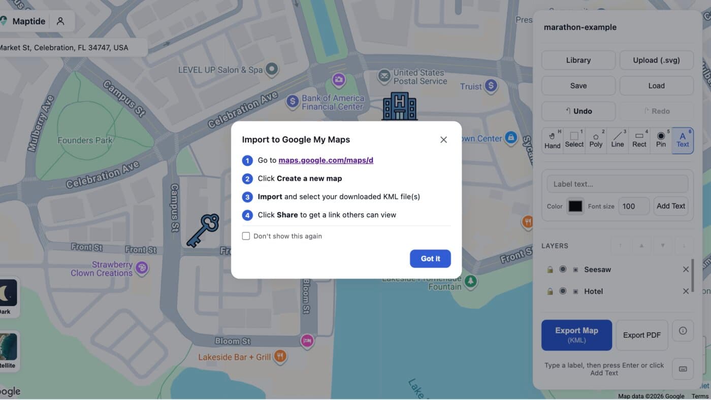
Mark the listing or model home
Search the property's address, then place a key icon on the real listing or model home.

Add the amenities nearby
Place icons for a nearby hotel and the neighborhood playground, positioned exactly where they sit on the real streets underneath.

Export to KML and open it in Google My Maps
One click exports a geo-accurate KML file. Import it into Google My Maps and paste the resulting link into the listing page or a buyer's packet.
Everything buyers ask about before an offer, marked on one map
The listing or model home
The exact lot, not just a pin somewhere on the block.
Clubhouse & amenities
Pools, gyms, and shared spaces, positioned at their real distance from the home.
Gated entry & security
Show how the community is accessed, not just where it sits.
Schools & parks
The details that turn a browsing buyer into a serious one.
Nearby dining & shopping
The five-minute walk that's easy to undersell in a listing description.
Future phases
Mark what's coming next for a development still under construction.
Common questions
How do I make a neighborhood amenity map for a listing or development?
Search the property's address in Maptide to pull up the real Google Map underneath, then place icons for the listing itself and every amenity nearby - the clubhouse, the gated entry, the park. Export it as a KML file and import it into Google My Maps to get a real, live link you can drop into a listing page or a buyer's packet.
Can buyers use it without downloading an app?
Yes. The output is a real Google Maps link, so it opens in the Google Maps app or browser buyers already have installed. Nothing to install, nothing that needs a login just to see how far the clubhouse is from the model home.
What's the difference between this and a static amenity graphic in the listing?
A static graphic shows amenities floating near a property without real distances or navigation. A Maptide map keeps the real Google Map underneath, so buyers get actual walking or driving directions between the listing and every amenity you've marked - and you can update it the moment a new phase of the development opens.
Can I show multiple properties or an entire subdivision on one map?
Yes - place a pin for each available lot or model home alongside the shared amenities, so one map covers an entire phase of a development instead of a single listing.
Does it cost anything to make an amenity map?
The editor and KML export are free. A small watermark appears on free exports; removing it and unlocking satellite view and custom SVG uploads is part of the paid Pro tier. See Pricing for details.
New listing going live?
Build your amenity map before the open house - it takes less time than writing the listing description.
Start your amenity map