A farmers market map maker vendors and shoppers both get.
Build a custom vendor layout map - every booth, food stall, and restroom - and share it as a real Google Maps link. No booth chart on a clipboard, no spreadsheet-turned-PDF nobody opens.
A real market map: Washington Square Park, New York
LiveA full row of vendor booths, produce stands, and the public restroom, laid out across the real park. This isn't a mockup below - drag it, zoom it, click a pin. It's a real Google Map.
This is what your own shoppers will get: a real, working map, not a PDF.
The market map problem nobody plans for
A farmers market or vendor event isn't a fixed floor plan - it's a layout that shifts week to week as vendors rotate, a food-truck row that needs power and water access, and a restroom line that gets asked about more than any single vendor. Most markets solve this with a hand-drawn booth chart for internal use, a static graphic posted to social media the week of, or nothing beyond “we're in the usual spot.” None of it helps a shopper standing at the entrance find the honey vendor, and all of it needs to be redrawn the moment the layout changes.
A custom market map fixes this by keeping the real Google Maps underneath your booth layout - shoppers get the navigation app already on their phone, with vendor icons layered on top so nobody wanders the whole market looking for the sourdough stand.
Design → export → share, in three steps
Place the free food-stall icon
Search your market's address, then drop the free food-stall icon on a vendor's real booth spot - no paywall on this icon.

Add every vendor to the layout
Drop an icon for each booth - cheese, produce, baked goods - onto its real spot in the market footprint.

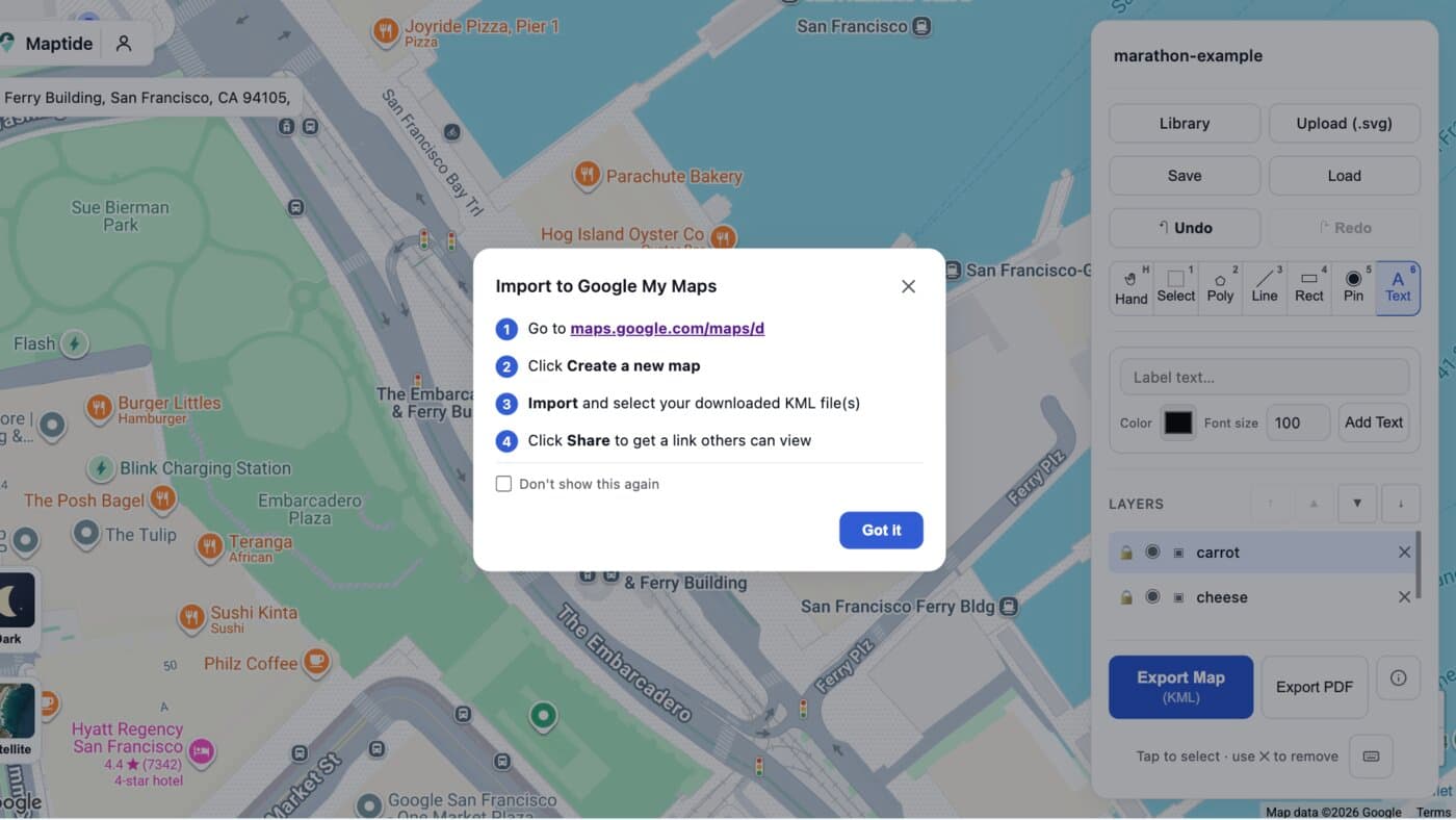
Export to KML and open it in Google My Maps
One click exports a geo-accurate KML file. Import it into Google My Maps and paste the resulting link into your market's website or a printed handout QR code.
Everything shoppers ask a volunteer about, marked on one map
Vendor booths
Cheese, produce, and baked goods, each with its own icon and real spot.
Food trucks & power hookups
Placed where utilities actually run, not just wherever fits.
Restrooms
The single most-asked question at any market, answered before it's asked.
Parking & entrances
So shoppers know which side of the block to approach from.
Rest areas & seating
Somewhere to sit near the food vendors so people stay longer.
Info booth & lost and found
Where to go when something - or someone - goes missing.
Common questions
How do I make a vendor layout map for my farmers market?
Search your market's address in Maptide to pull up the real Google Map underneath, then place the free food-stall icon (or any vendor icon) on each booth's actual spot. Export it as a KML file and import it into Google My Maps to get a real, live link. No spreadsheet-turned-PDF required.
Can shoppers and vendors use it without downloading an app?
Yes. The output is a real Google Maps link, so it opens in the Google Maps app or browser people already have. Vendors can check their spot the morning of, and shoppers can search for a specific stall before they even park.
What's the difference between this and a numbered booth chart?
A booth chart on a clipboard tells your team where things go - it doesn't help a shopper standing at the entrance find the honey vendor. A Maptide map keeps the real Google Map underneath your booth layout, so anyone can tap a pin and walk straight there, and you can move a vendor's pin in seconds when the layout changes week to week.
Can I update the map if vendors change week to week?
Yes - drag a pin to a new spot, relabel it, or delete it entirely, then re-export. Since the link points at your Google My Maps document, you can even swap the underlying KML without changing the URL you've already shared.
Does it cost anything to make a market map?
The editor and KML export are free, and the food-stall icon used in the example above is free on every tier - no paywall for the icon this page shows. A small watermark appears on free exports; removing it and unlocking satellite view and custom SVG uploads is part of the paid Pro tier. See Pricing for details.
Vendors confirmed for this week?
Build your market map before opening bell - it takes less time than answering one “where's the restroom” text.
Start your market map