A trail map maker hikers can actually navigate by.
Design a custom map of your park or nature reserve - trailhead, loops, overlooks, mileage - and share it as a real Google Maps link. No laminated kiosk map, no PDF that's unreadable on a phone screen.
A real trail map: Mohonk Preserve, New York
LiveLabyrinth Trailhead, Mohonk Lake, and the trail network around Mohonk Mountain House, marked with junctions and wildlife along the way. This isn't a mockup below - drag it, zoom it, click a pin. It's a real Google Map.
This is what your own hikers will get: a real, working map, not a PDF.
The trail map problem nobody plans for
A park or nature reserve's trail system isn't one address - it's a trailhead parking lot, a network of loops and spurs at different difficulty levels, a water crossing that floods in spring, and a summit overlook that's the whole reason people showed up. Most parks solve this with a laminated map bolted to a kiosk, a PDF on the website that's illegible once you're squinting at it on a trailhead's cell signal, or paint blazes on trees that only help once you're already on the trail. None of it gives turn-by-turn directions to the actual parking lot, and all of it goes stale the moment a trail reroutes around storm damage.
A custom trail map fixes this by keeping the real Google Maps underneath your design - hikers get the navigation app already on their phone, with your trailhead, junctions, and overlook icons layered on top so nobody ends up on the wrong loop an hour from the car.
Design → export → share, in three steps
Mark the trailhead
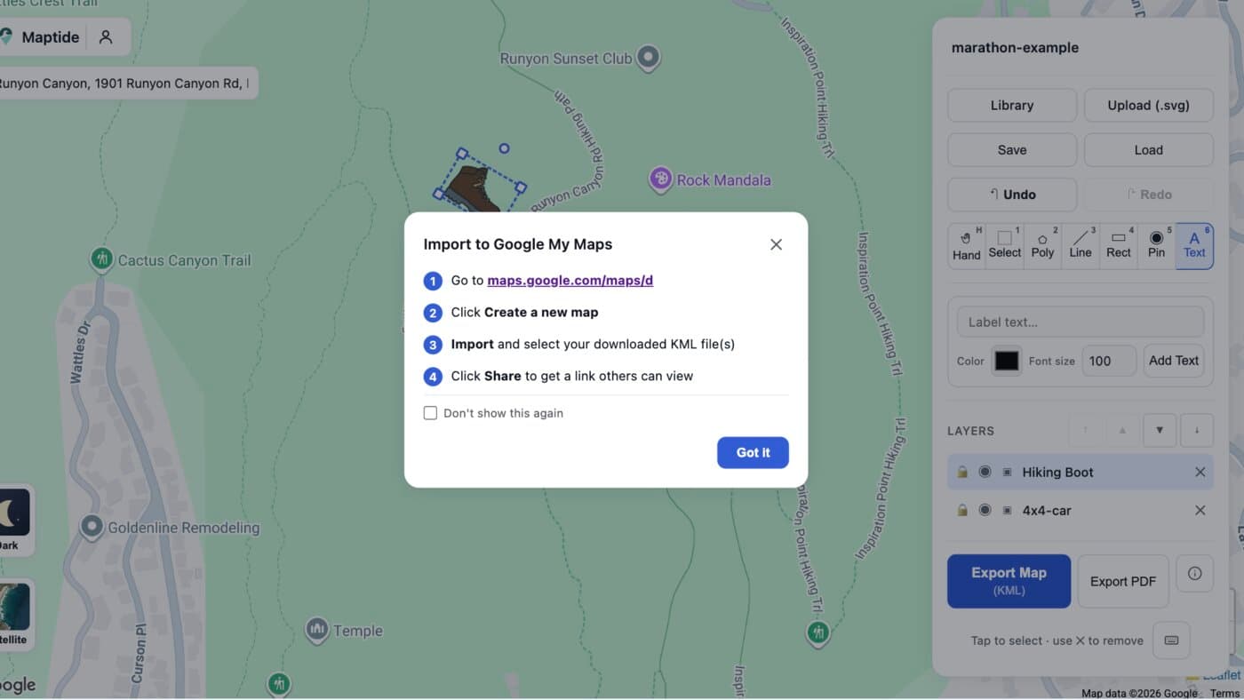
Search your park's address, then place a hiking-boot icon right on the real trailhead.

Mark backcountry access points
Add a 4x4 icon for a fire road or backcountry access point, positioned along the real trail line underneath.

Export to KML and open it in Google My Maps
One click exports a geo-accurate KML file. Import it into Google My Maps and paste the resulting link into a trailhead kiosk QR code or your park's website.
Everything hikers check before setting out, marked on one map
Trailhead & parking
The exact lot to park in, not just a pin somewhere inside the park.
Loop & spur junctions
Mark where trails split so nobody ends up on the wrong loop.
Scenic overlooks & waterfalls
Point out the reasons people are hiking in the first place.
Distance & difficulty
Label each segment so hikers can pick the right loop for their group.
Restrooms & water
The practical stuff nobody wants to discover they need mid-hike.
Visitor center & trail rules
Where to check conditions and closures before setting out.
Common questions
How do I make a custom trail map for a park or nature reserve?
Search your property's address in Maptide to pull up the real Google Map underneath, then place icons for the trailhead - a hiking boot works well - and any 4x4-accessible fire roads along the real trail. Export it as a KML file and import it into Google My Maps to get a real, live link. No GPS unit or GIS software required.
Can hikers use it without downloading an app?
Yes. The output is a real Google Maps link, so it opens in the Google Maps app or browser hikers already have installed. Nothing to install, nothing that needs a login just to check which loop is which before setting out.
What's the difference between this and the laminated map at the trailhead kiosk?
A kiosk map only helps once someone's already standing at the trailhead. A Maptide map gives hikers turn-by-turn directions to the actual parking lot, plus tappable pins for junctions, overlooks, and water crossings - and you can update it the moment a trail reroutes around storm damage, without reprinting anything.
Can I mark distance or difficulty on each trail segment?
Yes - label each pin or icon with the segment name, mileage, or difficulty rating your trail system already uses, so hikers can match what they see on your map to the signage on the ground.
Does it cost anything to make a trail map?
The editor and KML export are free. A small watermark appears on free exports; removing it and unlocking satellite view and custom SVG uploads is part of the paid Pro tier. See Pricing for details.
Trail season bringing more visitors?
Build your trail map before the next “which loop is the easy one” email - it takes less time than restocking the kiosk brochures.
Start your trail map